GIS-Potential Analysis Team
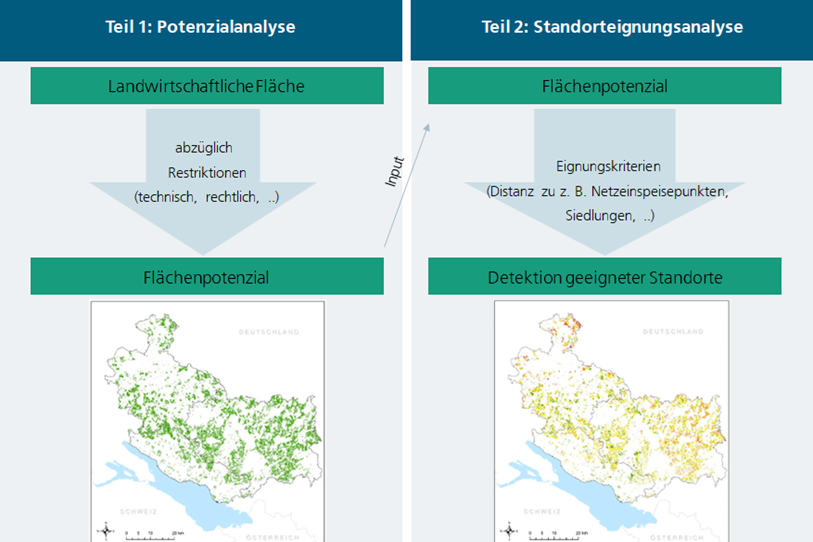
Potential analyses are a key tool in spatial planning for making informed decisions that combine economic and environmental benefits. As part of the assessment of regional opportunities for the implementation or promotion of agrivoltaics, we carry out such analyses to identify suitable areas.
We use geographic information systems (GIS) and take into account a variety of factors, including legal, agronomic and technical criteria such as irradiation, system design, soil conditions and agricultural use. Our aim is to evaluate the energy and agronomic potential of land and thus find optimal synergies between agriculture and photovoltaics.
Our services aim to support and optimize the implementation of agrivoltaic systems:
- Recording and classification of boundary conditions: We record and classify the conditions and requirements of agricultural land to determine its suitability for agrivoltaic systems. A variety of different criteria can be used and considered in the context of different scenarios.
- GIS-based potential analysis for different system designs: Using various models, we calculate the performance and energy potential for different agrivoltaic system designs and can thus support planning and decision-making.
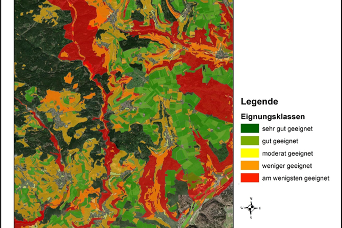
- Site suitability analysis: In addition to large-scale site assessment, we also carry out detailed site suitability analyses. Specific agrivoltaic systems can be modeled and evaluated according to various criteria such as proximity to the nearest grid feed point or to settlements.


